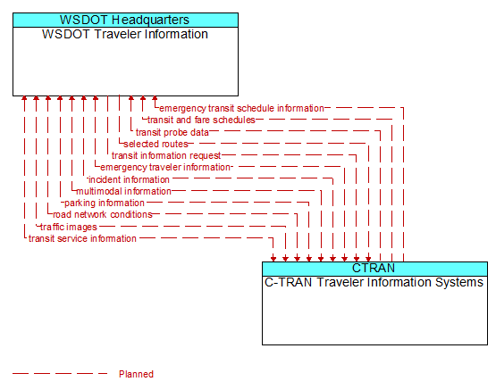
Interface: WSDOT Traveler Information - C-TRAN Traveler Information Systems
Architecture Flow Definitions
emergency transit schedule information (Planned) Applicable ITS Standards
Information on transit schedule and service changes that adapt the service to better meet needs of responders and the general public in an emergency situation, including special service schedules supporting evacuation.
emergency traveler information (Planned) Applicable ITS Standards
Public notification of an emergency such as a natural or man-made disaster, civil emergency, or child abduction. This flow also includes evacuation information including evacuation instructions, evacuation zones, recommended evacuation times, tailored evacuation routes and destinations, traffic and road conditions along the evacuation routes, traveler services and shelter information, and reentry times and instructions.
incident information (Planned) Applicable ITS Standards
Notification of existence of incident and expected severity, location, time and nature of incident. As additional information is gathered and the incident evolves, updated incident information is provided. Incidents include any event that impacts transportation system operation ranging from routine incidents (e.g., disabled vehicle at the side of the road) through large-scale natural or human-caused disasters that involve loss of life, injuries, extensive property damage, and multi-jurisdictional response. This also includes special events, closures, and other planned events that may impact the transportation system.
multimodal information (Planned) Applicable ITS Standards
Schedule information for alternate mode transportation providers such as train, ferry, air and bus.
parking information (Planned) Applicable ITS Standards
General parking information and status, including current parking availability.
road network conditions (Planned) Applicable ITS Standards
Current and forecasted traffic information, road and weather conditions, and other road network status. Either raw data, processed data, or some combination of both may be provided by this architecture flow. Information on diversions and alternate routes, closures, and special traffic restrictions (lane/shoulder use, weight restrictions, width restrictions, HOV requirements) in effect is included along with a definition of the links, nodes, and routes that make up the road network.
selected routes (Planned) Applicable ITS Standards
Routes selected based on route request criteria.
traffic images (Planned) Applicable ITS Standards
High fidelity, real-time traffic images suitable for surveillance monitoring by the operator or for use in machine vision applications.
transit and fare schedules (Planned) Applicable ITS Standards
Transit service information including routes, schedules, and fare information.
transit information request (Planned) Applicable ITS Standards
Request for transit operations information including schedule and fare information. The request can be a subscription that initiates as-needed information updates as well as a one-time request for information.
transit probe data (Planned) Applicable ITS Standards
Aggregate probe data derived from tracking transit vehicles. Data collected could include transit vehicle speeds and travel times for a given link or collection of links.
transit service information (Planned) Applicable ITS Standards
Transit service information including routes, schedules, and fare information as well as dynamic transit schedule adherence and transit vehicle location information.